Advanced settings usage
In the advanced settings, you can specify any parameter for the output side view, replot it, and reflect it on the calculation result window.
The figure below shows an example of the default side view.
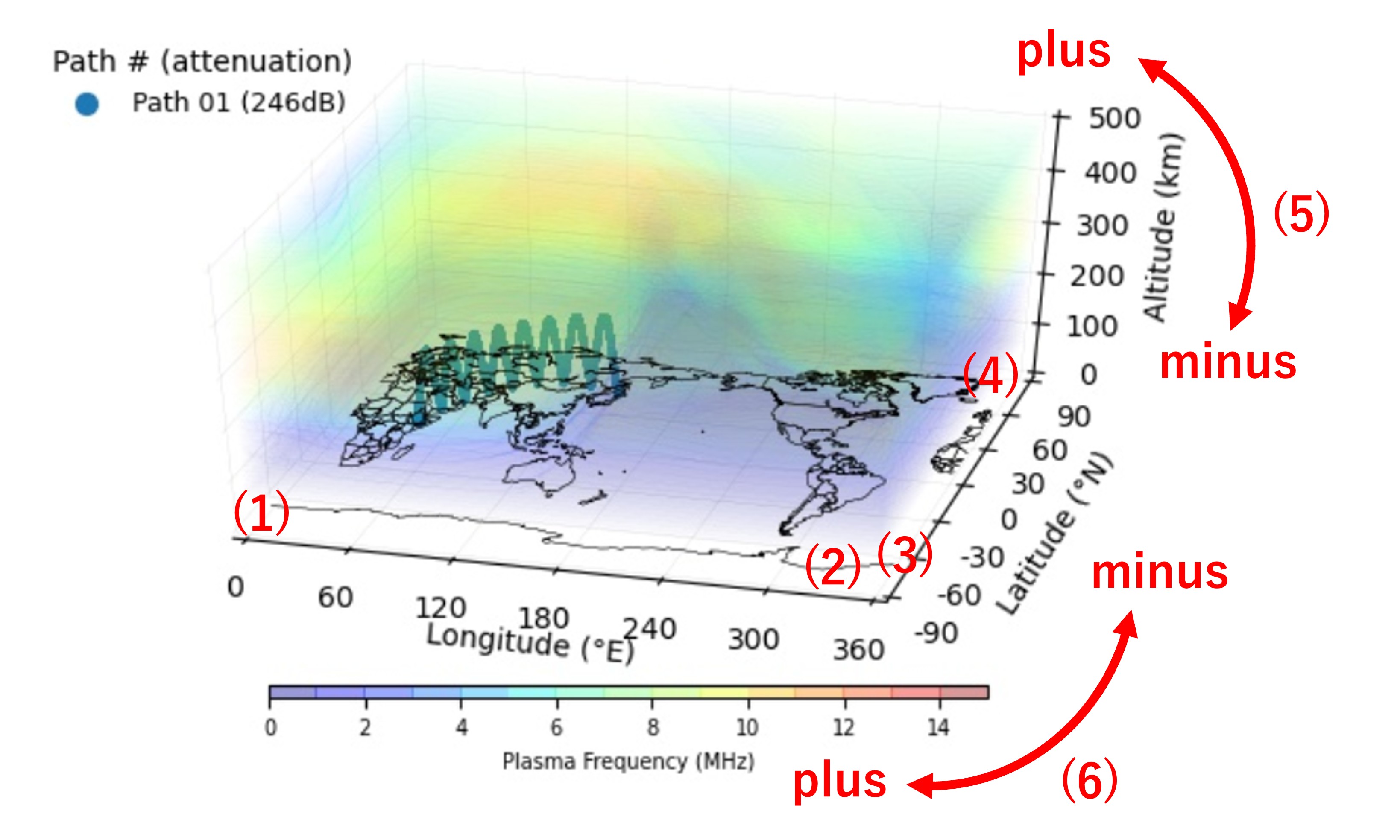
(1)Min.Longitude
This is the minimum longitude of the image to be recreated.The Min.Longitude can be specified in the range from -180 to 360.
(2)Max Longitude
This is the maximum longitude of the image to be recreated.The Max Longitude can be specified in the range from 0 to 540 (=360+180).
(3)Min.Latitude
This is the minimum latitude of the image to be recreated.The Min.Latitude is the latitude at the bottom of the image you want to recreate.
The Min.Latitude can be specified in the range from -90 to 90.
(4)Max Latitude
This is the maximum latitude of the image to be recreated.The Max Latitude is the latitude at the top of the image you want to recreate.
The Max Latitude can be specified in the range from -90 to 90.
(5)Depression
This is the depression of the image to be recreated.Increasing the depression will create an image rotated toward the plus side, and decreasing the value will create an image rotated toward the minus side.
The depression can be specified in the range from 0 to 90.
(6)Azimuth
This is the azimuth of the image to be recreated.The image viewed from the east facing west is taken as the base (angle = 0 degrees). Increasing the azimuth angle will rotate the image horizontally and clockwise by the angle, and decreasing the value will create an image rotated toward the minus side.
The azimuth can be specified in the range from 0 to 360.